Gesehen auf https://www.ostsee.de/baltic-sea-germany/visitor-arrival-direction-travel-information.php am 30.04.2025
Directions and travel information
Wherever you are coming from, getting to Germany's east coast is easier than you might think. Whether you choose to take a train, plane, car, coach or boat, the Baltic Sea in Germany is within your reach.

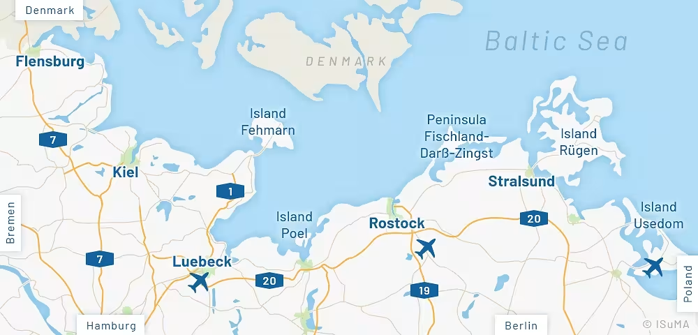
Take the plane to Rostock-Laage, Luebeck, Heringsdorf on the island of Usedom (May to October) or even Hamburg or Berlin and continue by train, car or shuttle to your holiday destination.
A number of ferries link major towns and places of interest along the Baltic Coast. Main ports are Sassnitz on the island of Ruegen, the Hanseatic city of Rostock, Luebeck-Travemuende, Kiel and Puttgarden on the island of Fehmarn.
The Baltic is easily accessible by car. Take the motorway A19 to Rostock, A1 to Luebeck and A7 to Flensburg.
In Germany the following speed limits apply (if not signed or stated otherwise) in built up areas 50km/h (app. 30mph), out of town 100km/h (app. 60mph). On most motorways there is no limitation.
Good rail links make the train a great way to get there. Main stations are Stralsund, Rostock, Wismar, Luebeck, Kiel and Flensburg. Local trains, buses and coaches take you to smaller places and holiday areas from here.
For entry into Germany citizens from non-EU countries need a travel visa. For more information contact the German Department of Foreign Affairs.
(no responsibility is taken for the correctness of this information)
